START (सुरुवात )
MAHARASHTRA STATE
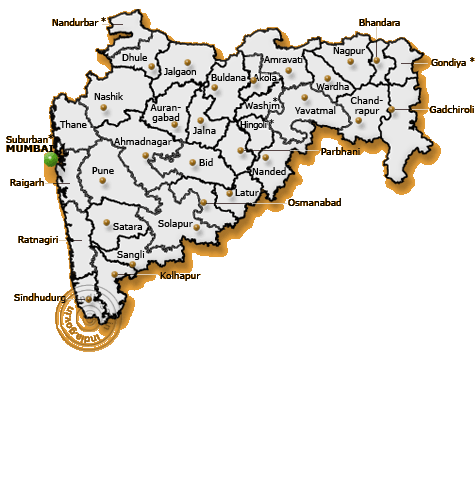
Geographical Profile
The word Maharashtra, the land of the Marathi speaking people, appears to be derived from Maharashtri, an old form of Prakrit. Some believe that the word indicates that it was the land of the Mahars and the Rattas, while others consider it to be a corruption of the term 'Maha Kantara' (the Great Forest), a synonym for 'Dandakaranya'.
The Land
Located in the north centre of Peninsular India, with a command of the Arabian Sea through its port of Mumbai, Maharashtra has a remarkable physical homogeneity, enforced by its underlying geology. The dominant physical trait of the state is its plateau character. The Maharashtra Desh is a plateau of plateaux, its western upturned rims rising to form the Sahyadri Range and its slopes gently descending towards the east and southeast. The major rivers and their master tributaries have carved the plateaux into alternating broad-river valleys and intervening higher lever interfluves, such as the Ahmednagar, Buldana, and Yavatmal plateaux.
The Sahyadri Range is the physical backbone of Maharashtra. Rising on an average to an elevation of 1000m. it falls in steep cliffs, to the Konkan on the west. Eastwards, the hill country falls in steps through a transitional area known as Mawal to the plateau level. The series of crowning plateaux on the crest forms a distinctive feature of the Sahyadri Range.
The Konkan, lying between the Arabian Sea and the Sahyadri Range is narrow coastal lowland, barely 50 km. wide. Though mostly below 200 m., it is far from being a plain country. Highly dissected and broken, the Konkan alternates between narrow, steep-sided valleys and low laterite plateaux.
The Satpudas, hills along the northern border, and the Bhamragad-Chiroli-Gaikhuri Ranges on the eastern border form physical barriers preventing easy movement, but also serve as natural limits to the state.
Geology and Topography
Except around Mumbai, and along the eastern limits, the State of Maharashtra presents a monotonously uniform, flat-topped skyline. This topography of the state is the outcome of its geological structure. The state area, barring the extreme eastern Vidarbha region, parts of Kolhapur and Sindhudurg, is practically co-terminous with the Deccan Traps. Roughly 60 to 90 million years ago, the outpouring of basic lava through fissures formed horizontally bedded basalt over large areas. Variations in their composition and structure have resulted in massive, well-jointed steel-grey cliff faces alternating with structural benches of vesicular amygdaloid lava and ash layers, all of which contribute to the pyramida-shaped hills and crest-level plateaux or mesas. Earth sculpturing under the tropical climate completed the panorama-sharply defining the landform features in the semi-arid conditions, and rounding the hilltops under wetter condition. Fluvial action by the Krishna, Bhima, Godavari, Tapi-Purna and Wardha-Wainganga river systems has further aided in the compartmentalisation of the Desh into broad, open river valleys, alternating with plateau interfluves, that form the ribs of the Sahyadrian backbone. In sharp contrast, the hill torrents of the Konkan, barely a 100 km. long, tumble down as roaring streams which flow in deeply entrenched valleys to terminate in tidal estuaries.
Climate
The state enjoys a tropical monsoon climate; the hot scorching summer from March onwards yields to the rainy monsoon in early June. The rich green cover of the monsoon season persists during the mild winter that follows through an unpleasant October transition, but turns into a dusty, barren brown as the summer sets in again. The seasonal rains from the western sea-clouds are very heavy and the rainfall is over 400 cm., on the Sahyadrian crests. The Konkan on the windward side is also endowed with heavy rainfall, declining northwards. East of the Sahyadri, the rainfall diminishes to a meagre 70 cm. in the western plateau districts, with Solapur-Ahmednagar lying in the heart of the dry zone. The rains increase slightly, later in the season, eastwards in the Marathwada and Vidarbha regions.
The highly pulsatory character of the monsoon, with its short spells of rainy weather and long dry breaks, floods, as well as droughts add much to the discomfort of the rural economy.
The highly pulsatory character of the monsoon, with its short spells of rainy weather and long dry breaks, floods, as well as droughts add much to the discomfort of the rural economy.
Resources
Forests comprising only 17% of the state area cover the eastern region and the Sahyadri Range, while open scrub jungle dots the plateaux. If Maharashtra represented the Maha Kantara in the historic past, today little of it is left; vast sections have been denuded and stripped of the vegetal cover.
The soils of Maharashtra are residual, derived from the underlying basalts. In the semi-dry plateau, the regur (black-cotton soil) is clayey, rich in iron, but poor in nitrogen and organic matter; it is moisture-retentive. Where redeposited along the river valleys, those kali soils are deeper and heavier, better suited for rabi crops. Farther away, with a better mixture of lime, the morand soils form the ideal Kharif zone. The higher plateau areas have pather soils, which contain more gravel. In the rainy Konkan, and the Sahyadri Range, the same basalts give rise to the brick-red laterites productive under a forest-cover, but readily stripped into a sterile varkas when the vegetation is removed. By and large, soils of Maharashtra are shallow and somewhat poor.
Water is the most precious natural resource of the state, greatly in the demand, and most unevenly distributed. A large number of villages lack drinking water, especially during the summer months, even in the wet Konkan. Barely 11% of the net sown area is irrigated. Perched water tables in the basalt aquifers have contributed to increased well irrigation, which accounts for approximately 55% of the irrigable water. The granitic-gneissic terrain in the eastern hilly area of Vidarbha accounts for all tank irrigation. Tube-wells in the Tapi-Purna alluvium and shallow wells in the coastal sands are the other main sources of water.
The mineral-bearing zones of Maharashtra lie beyond the area of the basalts in eastern Vidarbha, southern Kolhapur and the Sindhudurg area. The Chandrapur, Gadchirali, Bhandara and Nagpur Districts form the main mineral belt, with coal and manganese as the major minerals and iron ore and limestone as potential wealth. The Ratnagiri coast contains sizeable deposits of illimenite.
PRINCIPAL CITIES
Principal Cities
In contrast to the agrarian economy that characterises India, Maharashtra stands out, with the highest level of urbanisation of all Indian states. The mountainous topography and soil are not as suitable for intensive agriculture as the plains of North India; therefore, the proportion of the urban population (38.69 per cent) contrasts starkly with the national average (25.7 per cent).
The state has one metropolitan city, two mini-metropolises and many large towns. Mumbai is the state capital, with a population of approximately 9.926 million people. The other large cities are Pune, Nasik, Nagpur, Aurangabad and Kolhapur.
The state has one metropolitan city, two mini-metropolises and many large towns. Mumbai is the state capital, with a population of approximately 9.926 million people. The other large cities are Pune, Nasik, Nagpur, Aurangabad and Kolhapur.
Mumbai - The Gateway of India
The earliest inhabitants of the seven islands of Mumbai were the Kolis, a fishing community. They called the islands "Mumba-aiee (mother Mumba)" out of a reverence for Mumbadevi, their patron deity. Over history, the seven islands were linked and conglomerated, forming a city which commands the currency and commerce of India.
The origins of modern Mumbai hark back to 1662, when Catherine of Braganza, the sister of the King of Portugal, married Charles the II. The Portuguese, who then ruled the islands, included them as part of the wedding dowry. In 1668, when the coffers of England were almost empty, Charles the II sold his dowry to the East India Company, a trading venture, which fully appreciated Mumbai’s natural advantages; a magnificent harbour sheltered from the monsoon winds encouraged the Company to shift its headquarters from Surat to Mumbai. The Company established docks, a printing press and a mint and invited rich merchants and ship builders to the city, promising freedom of worship. Armenians, Gujaratis, Parsis, Jews and Christians soon arrived, giving Mumbai its cosmopolitan character and the work ethic which survives even today.
Mumbai is the financial and commercial capital of India. It has the largest proportion of taxpayers in India and its share markets transact almost 70 per cent of the country’s stocks.
Mumbai offers a lifestyle that is rich, cosmopolitan and diverse, with a variety of food, entertainment and nightlife available in a form and abundance comparable to that in world capitals.
The largest number of Victorian buildings in the world are juxtaposed with some of the most modern. Four golf courses, speciality race courses and polo grounds, numerous cricket arenas and facilities for other sports - ranging from bridge to chess and billiards - are available at clubs across the city.
The world famous Prince of Wales Museum houses an exquisite collection of Rajput and Mughal miniatures, as well as rare pieces of Tibetan, Japanese and Chinese art. Mumbai is the home of the Hindi film industry, known as Bollywood, distinguished by prolific records in production. Cinemas showing the newest films from the West, theatres with Indian and English plays and dance and music performances can be seen in auditoria all across the city.
Mumbai has dynamic transportation links with the rest of India and the world. The trading ports, Mumbai and Nhava Sheva, offer connections with major ports worldwide. The international airport at Sahar (recently renamed Chhatrapati Shivaji Maharaj International Airport) and the domestic terminal at Santa Cruz (also called Chhatrapati Shivaji Maharaj Airport) receive major airlines of the world, as well as the services of domestic airlines. The Western, Central and Harbour railway lines connect the city to distant suburbs and destinations across India, while the BEST (Bombay Electrical Supply and Transport) buses provide services relied on by 9.926 million people in Mumbai.
Pune
Pune, the second largest city in Maharashtra, is the state's cultural capital, with a population of 2.5 million people. About 170-km from Mumbai by road, Pune was the bastion of the Maratha empire. Under the reign of the Peshwas - key ministers in the Maratha Empire - Pune blossomed into a centre of art and learning. Several far-reaching revenue and judicial reforms were also initiated in the city.
The British developed Pune as a military town when they captured it in 1818. Educational institutes there include the College of Military. Engineering and the University of Pune, which offers a diverse choice of engineering, agriculture and technical courses.
A number of industries were located in Pune after Independence, as the city had well-connected road and rail links and a pool of technical and professional personnel.
Bajaj Auto, the world’s largest manufacturer of scooters and three wheelers, TELCO (Tata Electric and Locomotive Company), the manufacturer of India’s primary commercial vehicles and trucks, and the luxury car-maker, Mercedes Benz are located here. Software companies are the newest entrants into Pune's vibrant atmosphere. With the setting up of these new industries, there has been a corresponding increase in both the population and standards of lifestyle; today Pune is rapidly maturing into a prime industrial town, while retaining all its old charm, a unique blend of British and Maratha influences.
Nasik
One of the holy cities of the Hindu tradition, Nashik lies on the banks of the sacred river Godavari and has a population of about 0.725 million people. It is believed that Lord Rama, hero of the great Indian epic, the Ramayana, spent a major part of his exile here. Nashik is also a temple town, with over 200 temples.
Nashik is located at a distance of 195 km from Mumbai by road on the Bombay-Agra highway. It is also a major pilgrimage centre. The greatest event in Nashik is the sacred Kumbha Mela, held to commemorate a mythological story. The mela (a religious carnival) occurs every 12 years (equal to one day for the gods) and attracts millions of people from India and abroad. This event is held alternately at Nashik, Hardwar, Ujjain and Allahabad, which are among the major pilgrimage centres in the country.
Nashik is located at a distance of 195 km from Mumbai by road on the Bombay-Agra highway. It is also a major pilgrimage centre. The greatest event in Nashik is the sacred Kumbha Mela, held to commemorate a mythological story. The mela (a religious carnival) occurs every 12 years (equal to one day for the gods) and attracts millions of people from India and abroad. This event is held alternately at Nashik, Hardwar, Ujjain and Allahabad, which are among the major pilgrimage centres in the country.
Nagpur
The nerve centre of Vidarbha (eastern Maharashtra), Nagpur - the 'orange city' as it is known - is located in the heart of India, with a population of about 1.7 million people. It is dotted with many picturesque sites, including the civil lines and well-laid-out gardens. Nagpur has much to offer by way of relaxation. It was the old capital of the Bhonsale rulers, the former Central Provinces and Berar. The city is noted for its antiquity and is about 868 km from Mumbai by road.
Nagpur is a growing industrial centre and the home of several industries, ranging from food products and chemicals to electrical and transports equipment.
Nagpur is a growing industrial centre and the home of several industries, ranging from food products and chemicals to electrical and transports equipment.
Aurangabad
Malik Ambar, the Prime Minister of Murtaza Nizam Shah II, and the then ruler of the Deccan (central parts of Southern India), founded Aurangabad in 1610. The city has a population of about 0.593 million people.
Aurangabad derives its name from Prince Aurangzeb (who later became a Mughal emperor), who made it his regional capital when he was Viceroy of Deccan. His legacy is reflected in the architecture of the city. Even today, Aurangabad is a hub of culture and history in the Marathwada region. The Bibi-ka-Maqbara is the only example of Mughal architecture in the Deccan plateau; it was built in 1679 as a tribute to Aurangzeb’s wife, Begum Rabia Durani, by his son.
Close to the city of Aurangabad are the famous Ajanta nd Ellora caves, an architectural marvel. Through the caves, visitors can trace the evolution of three great world religions - Buddhism, Hinduism and Jainism.
Aurangabad is famous for Paithani saris, himroo shawls and bidri work (zinc with silver embedding).
Kolhapur
In southern Maharashtra, on the banks of the river Panchganga, Kolhapur is an ancient town known for its exquisite palaces and forts. In 1945, archaeological excavations close to a hill near Kolhapur revealed the existence of an ancient town dating back to the times of the Roman empire. Today, Kolhapur is a modern city with a population of about 0.419 million people and a thriving industrial infrastructure.
posted by KOKANASTH at 8:54 PM
![]()

2 Comments:
Really good :)
keep it up
THANKS AMIT....
Post a Comment
<< Home